AI-enabled UAVs and Multimodal Monitoring for Protected and Controlled Environment (PACE)
Overview
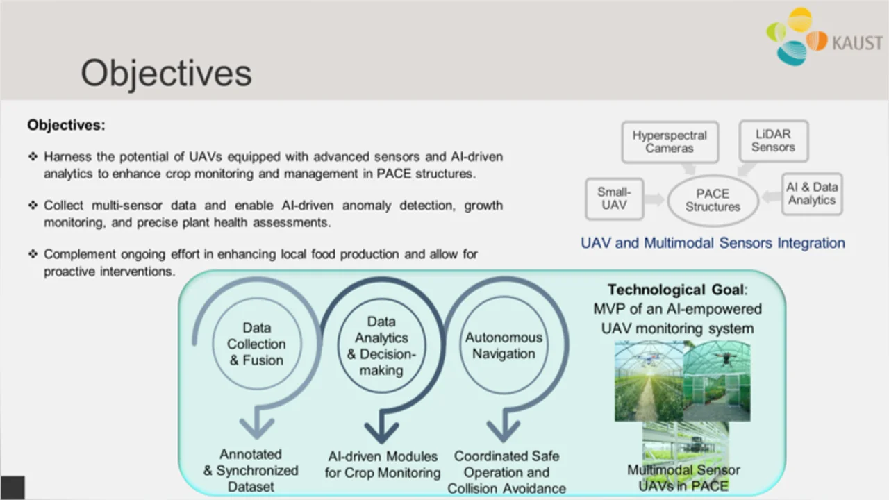
This project aims to utilize advanced technologies for UAVs to enhance the efficiency, accuracy, and responsiveness of crop monitoring and management within the diverse PACE settings. The primary objectives revolve around employing a fleet of micro-UAVs equipped with cameras and LiDAR sensors to capture high-resolution images and 3D point clouds and perform multi-layered AI analysis. While cameras offer visual insights into surface-level plant health and characteristics, LiDAR provides deeper insights about plant physical attributes for a more comprehensive crop assessment. This project is three-folded as follows:
Data Collection and Fusion: This task aims to utilize UAVs equipped with LiDAR and cameras to collect comprehensive data within PACE structures. It will also focus on the fusion of LiDAR-generated point clouds with visual data from multispectral cameras to generate annotated and synchronized datasets. This integration will allow for the design of AI-driven plant growth and health monitoring.
Data Analytics and Decision-Making: In this task, the goal is to develop AI-driven data analytics tools to process the integrated sensor data. These tools will be instrumental in generating real-time alerts and actionable insights, aiding in timely decision-making to address detected issues and optimize crop management strategies.
Autonomous Navigation in PACE: This task will focus on designing autonomous navigation techniques for UAV fleets within the constrained and complex 3D PACE structures, which include closed environments and indoor farms featuring high racks. This task involves the development of navigation algorithms that ensure safe and efficient movement of UAVs while collaboratively monitoring data with multimodal sensors and avoiding collision with static and dynamic obstacles.